Launch/Reentry Analyses and Visualizations
AS&T provides high-fidelity launch and reentry analyses and visualizations that show National Airspace System performance from an air traffic flow management perspective.

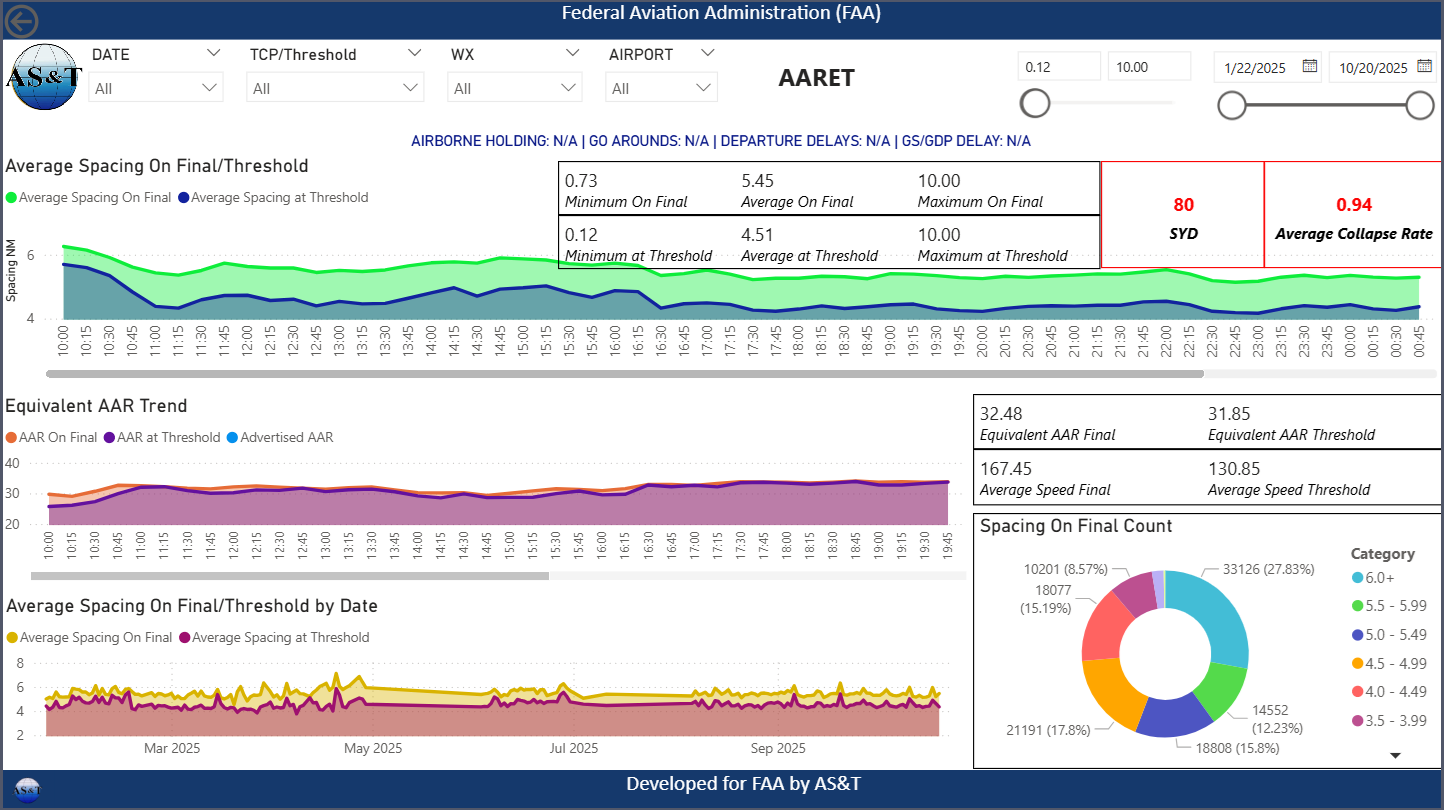
Airport Arrival Rate Evaluation Tool (AARET)
AARET measures and quantifies the relationship between the final approach fix and runway threshold. This data-driven output provides an accurate prediction of airport arrival capacity resulting in increased system efficiency, reduced Air Traffic Control delays, and reduced controller workload.
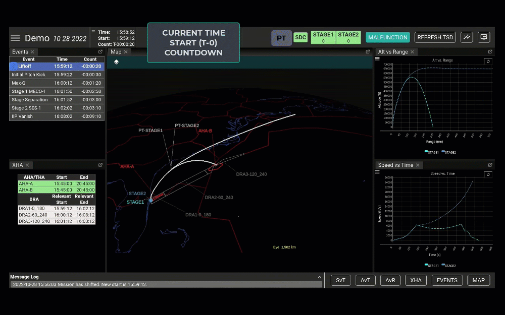
Space Data Integrator (SDI)
SDI provides seamless spaceflight integration within the National Airspace System by automating real-time data sharing from Launch and Reentry Operators. SDI transforms how the Federal Aviation Administration tracks and manages launch trajectories, hazards, and contingencies.
Complex Airspace Analyses
AS&T is internationally recognized for its deep-dive post-event analyses of major National Airspace System events. Our insights equip Federal Aviation Administration leadership with a clear, data-driven understanding of what occurred and why.

Modeling & Simulations
AS&T delivers holistic, high-fidelity trajectory modeling and simulations designed to elevate system efficiency across the National Airspace System.
